The satellite report on the property, ready to hand to your buyer or your seller
You send us the listing. Within 48 hours you receive an 11-page PDF that shows how the property has changed since 2005, what the Cadastre says about its area and buildings, and what the satellite sees today. With the source of every image and every figure.
No upfront payment+34 613 04 08 95info@fincahub.comNot a valuation or a certification
 1Cover with the property sheet and sources2Orthophotos 2005, 2013, 2022 and 20253PDF · 11 pages
Nobody buys a 75-hectare property from a photo in a listing
Buyers want to know what is really there: whether the area matches the listing, whether the buildings exist in the Cadastre, whether the property is in better or worse shape than ten years ago. Today that is settled with a site visit, a call to a surveyor or a “trust me”. This report puts it in writing, with official sources, before the visit.
For the agency
A serious document to hand over with the listing. Fewer wasted viewings, fewer unanswered questions and a reason for the buyer to call you.
For the buyer
What they would ask if they knew what to ask: measured area, registered built-up m² versus what is visible, Cadastre land uses versus the listing, terrain and slopes, and how the tree cover has evolved.
What it is not
It is not a valuation, an expert report, or a cadastral or land-registry certification. It is an orderly reading of official public data that separates what is observed from what is interpreted.
Ten situations at a rural-property agency where the report saves a trip, an argument or a failed sale
Today, when a buyer asks about the area, the buildings or the condition of a property, the agency turns to the Cadastre viewer, SIGPAC, Google Earth and its own word; if things get serious, a surveyor (€400 to €500 and several days). The report puts that answer in writing, with official sources, within 48 hours.
Win the exclusive listing.Arrive at the meeting with the owner with the report on their property already done. No other agency turns up with that.
Defend the price.Measured area, Cadastre and listing side by side, plus the real slope: arguments for the owner who asks too much and for the buyer who offers too little.
Filter before the viewing.The prospect receives the PDF, and questions about access, trees and terrain are settled in writing. Fewer two-hour drives to properties that were not what they wanted.
Spot the barn before the notary does.A building visible in the photo with 0 m² in the Cadastre is the question that halts a sale at the notary. Caught in time, it can be regularised or priced in.
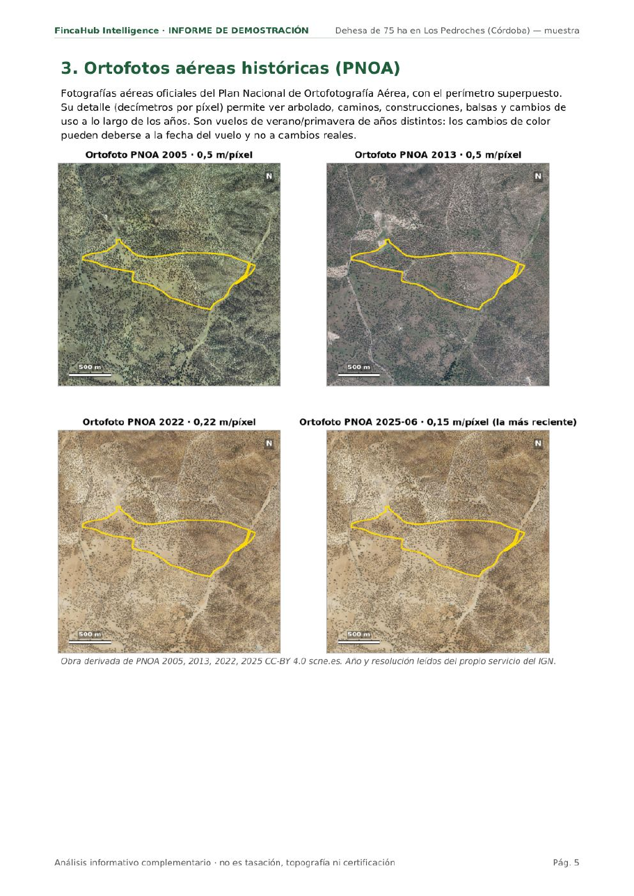
Show how it has changed.Official photos from 2005, 2013, 2022 and 2025 with the same boundary: useful for “look how well it has been kept” and for justifying a price cut.
Compare properties for an investor.Five dehesas, five reports with the same structure. The agency becomes the one who organises the decision.
Sell remotely.Buyers from another region or from outside Spain who cannot visit three times: the report acts as the first viewing and leaves the second for closing.
Cover yourself.A PDF with a source and date on every image, kept on file, in case of a later claim about the area or the buildings.
Material for the listing.The 2005→2025 comparison and the satellite images give the agency’s portal and social media something different from the usual photos.
Include it or charge for it.As part of the exclusive-listing service, or separately to the buyer who wants the study before making an offer. It costs less than a trip out.
| What the agency does today | With the report | |
|---|---|---|
| Actual area | Cadastre, SIGPAC and “what the deeds say”; if in doubt, a surveyor: €400–500 and days | Geodesic, UTM, Cadastre and listing side by side, in 48 h |
| Buildings | What you see on the viewing and what the owner says | What is visible at 0.15 m/pixel versus the m² registered in the Cadastre |
| Condition and change | Google Earth with whatever date it happens to show | Four official orthophotos and 36 months of satellite data, same season every year |
| What the buyer receives | The listing and your word | An 11-page PDF with the source of every figure |
The online valuation reports available today (around €30) give an indicative price based on the Cadastre; they do not measure the property or show how it has changed. This is not a valuation: it is an orderly reading of what is already public, before the viewing.
Eleven pages, all with real images of the property
These are unretouched pages from the sample report. Click any of them to enlarge it.
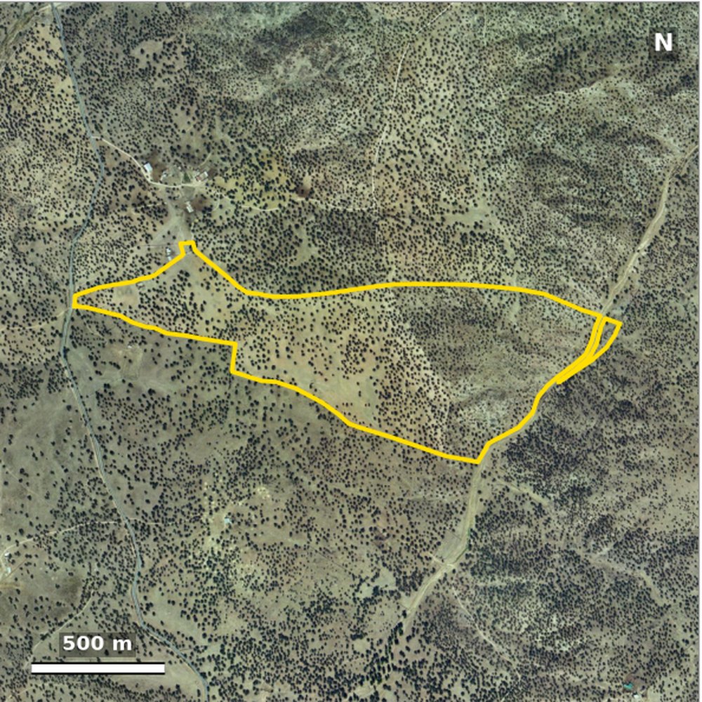
 20052025
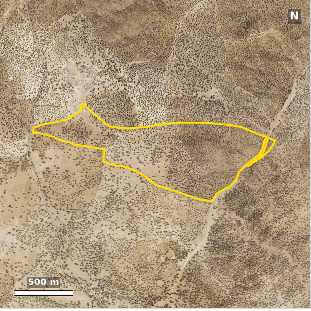
PNOA orthophoto 2025-06 · 0.15 m/pixel · 75 ha dehesa (real sample). Derived from PNOA 2005 and PNOA 2025 CC-BY 4.0 scne.es · boundary: Cadastre, no legal value.
How it has changed since 2005
Four dates of official IGN aerial photography, always with the same boundary overlaid: you can see what has been built, what has been felled and which tracks have changed.
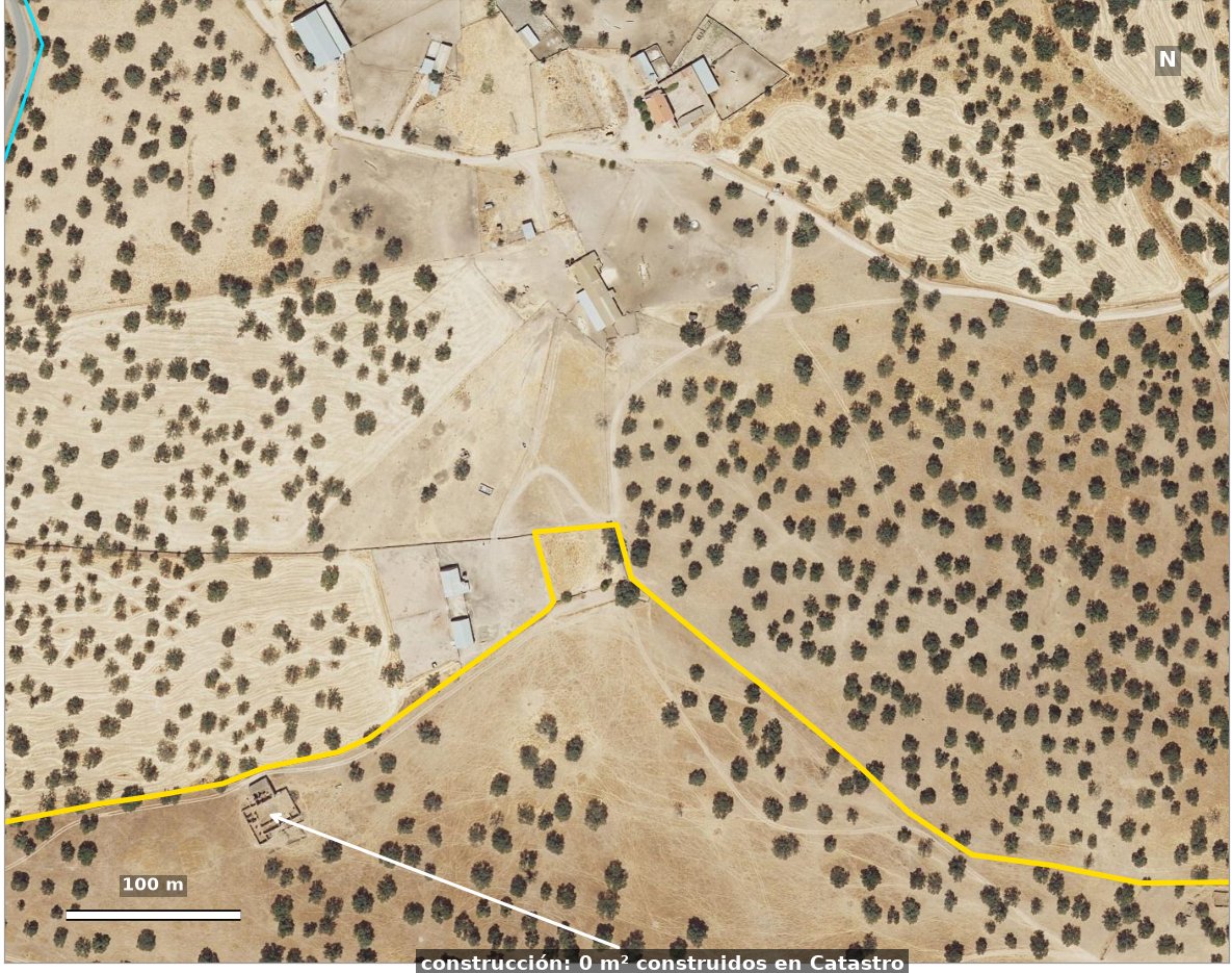
Built versus registered
Detail view at 0.15 m/pixel. Here, a visible building with 0 m² in the Cadastre: the question the buyer will ask you, answered in advance.
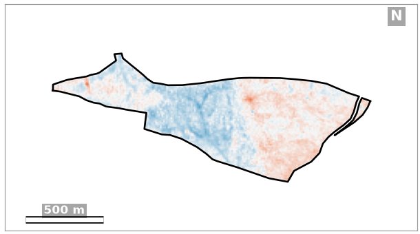
What has really changed
Vegetation change 2019 → 2026, net of the changes in the surrounding area: what belongs to the property itself.
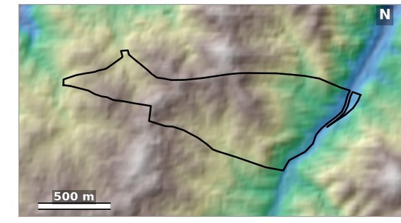
Terrain and slopes
Elevations and slope of the terrain from the Copernicus elevation model (30 m).
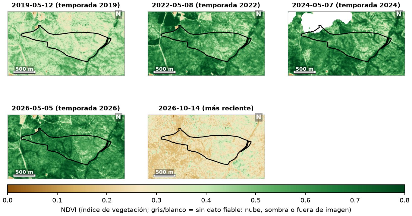
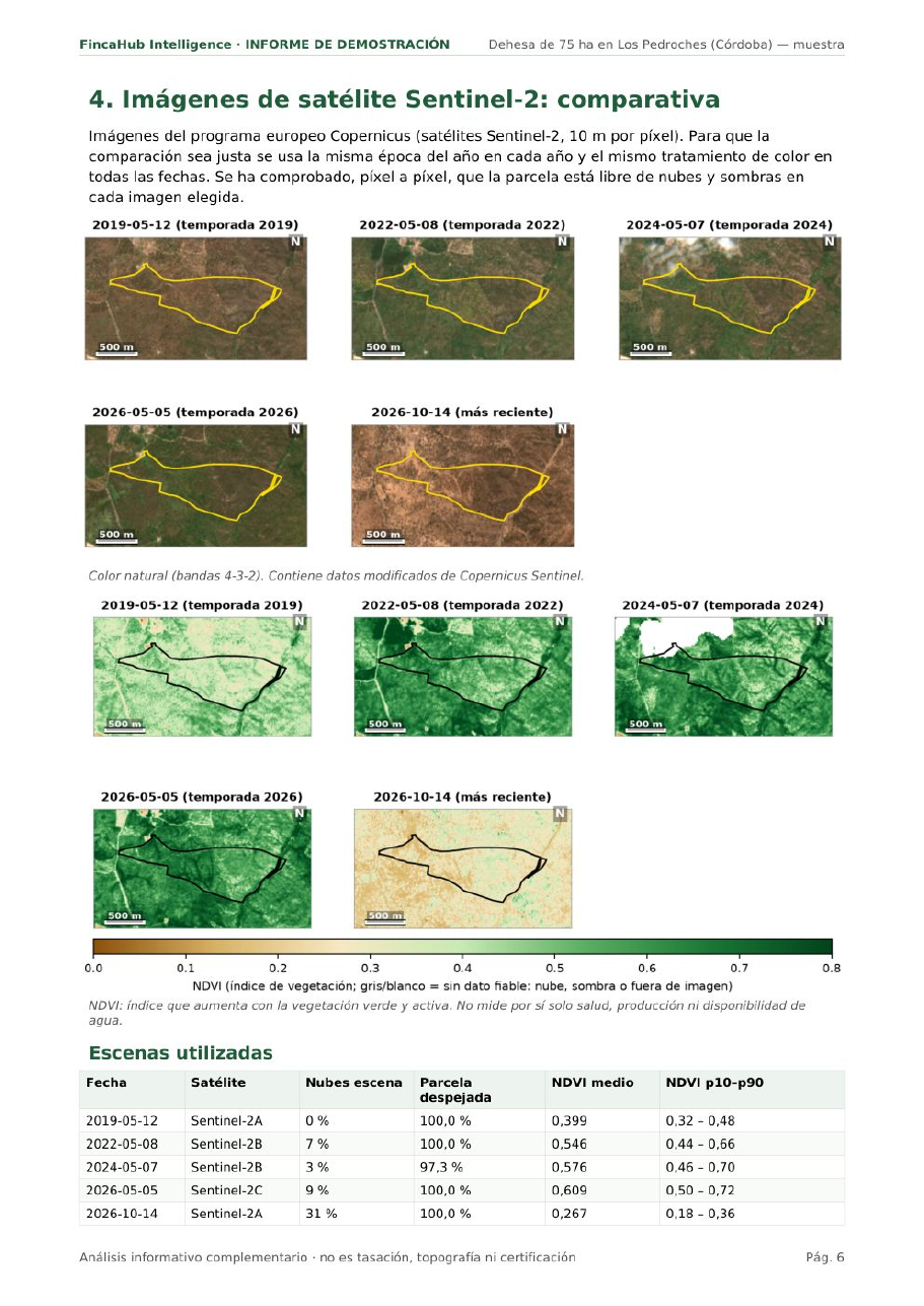
Sentinel-2 satellite, same season every year
Cloud-free images from 2019, 2022, 2024 and 2026, comparable with each other, plus the most recent one.
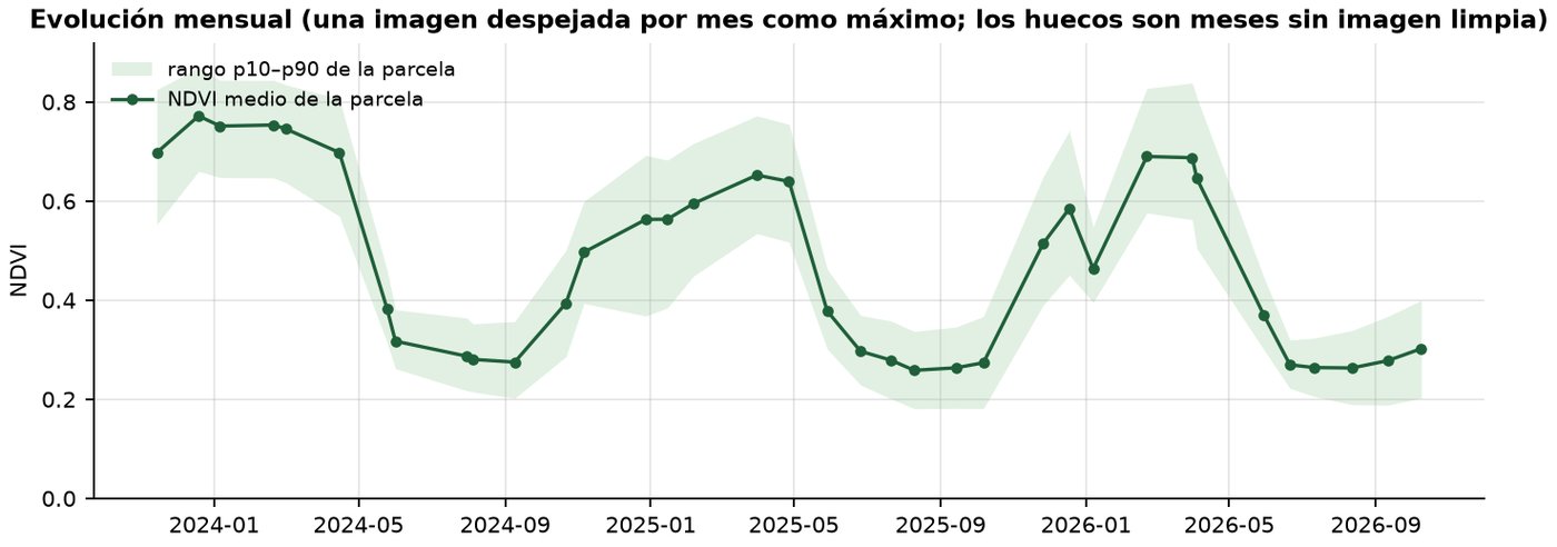
36 months of change
One clear image per month: you can see the dehesa’s cycle and whether one year was better or worse than another.
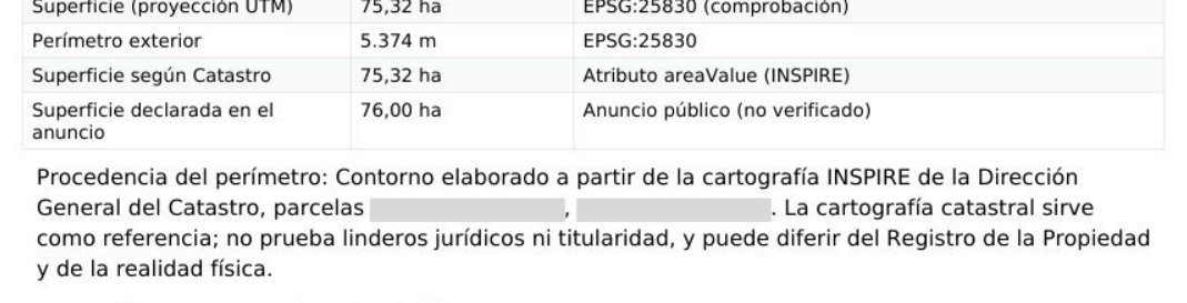
Measured area
Geodesic, UTM, Cadastre and listing figures, side by side.
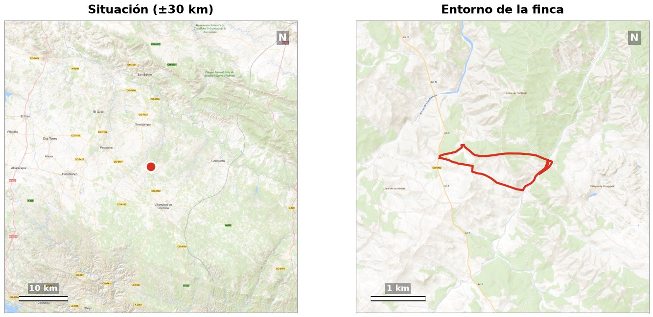
Location and access
Where it is, how to get there and what is around it.
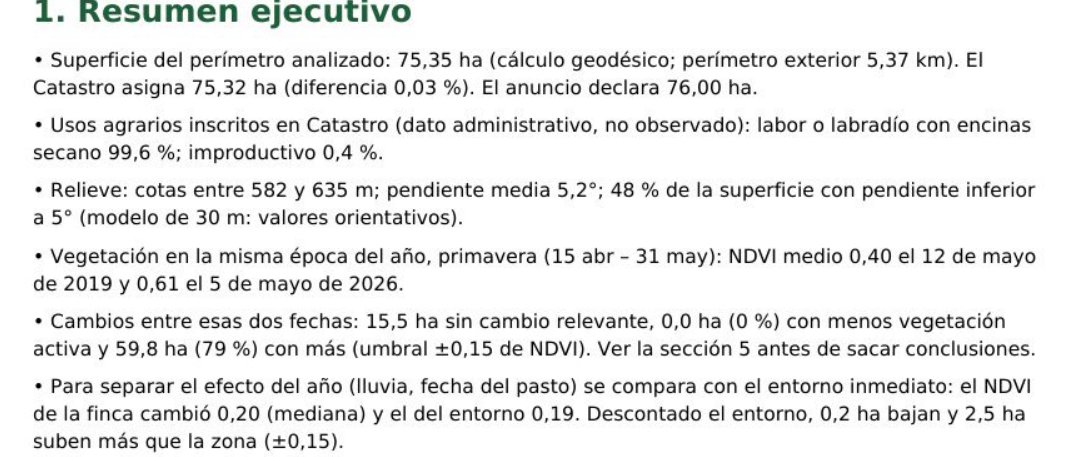
A two-minute summary
What was observed, what was interpreted and what is worth asking, on one page.
Three steps, 48 hours, official sources only
You send us the listing
The listing link, the cadastral reference or the polygon and plot number. If it is outside Spain, the property boundary.
We measure and compare
We download IGN orthophotos from several years, cloud-free satellite images, the Cadastre’s parcels and buildings, and the terrain. We measure the area, and a person reviews everything and writes the observations.
You receive the PDF
Within 48 working hours, for your records and for the buyer. Every image with its date and source. One correction included if anything in the listing changes.
Read a full report before ordering yours
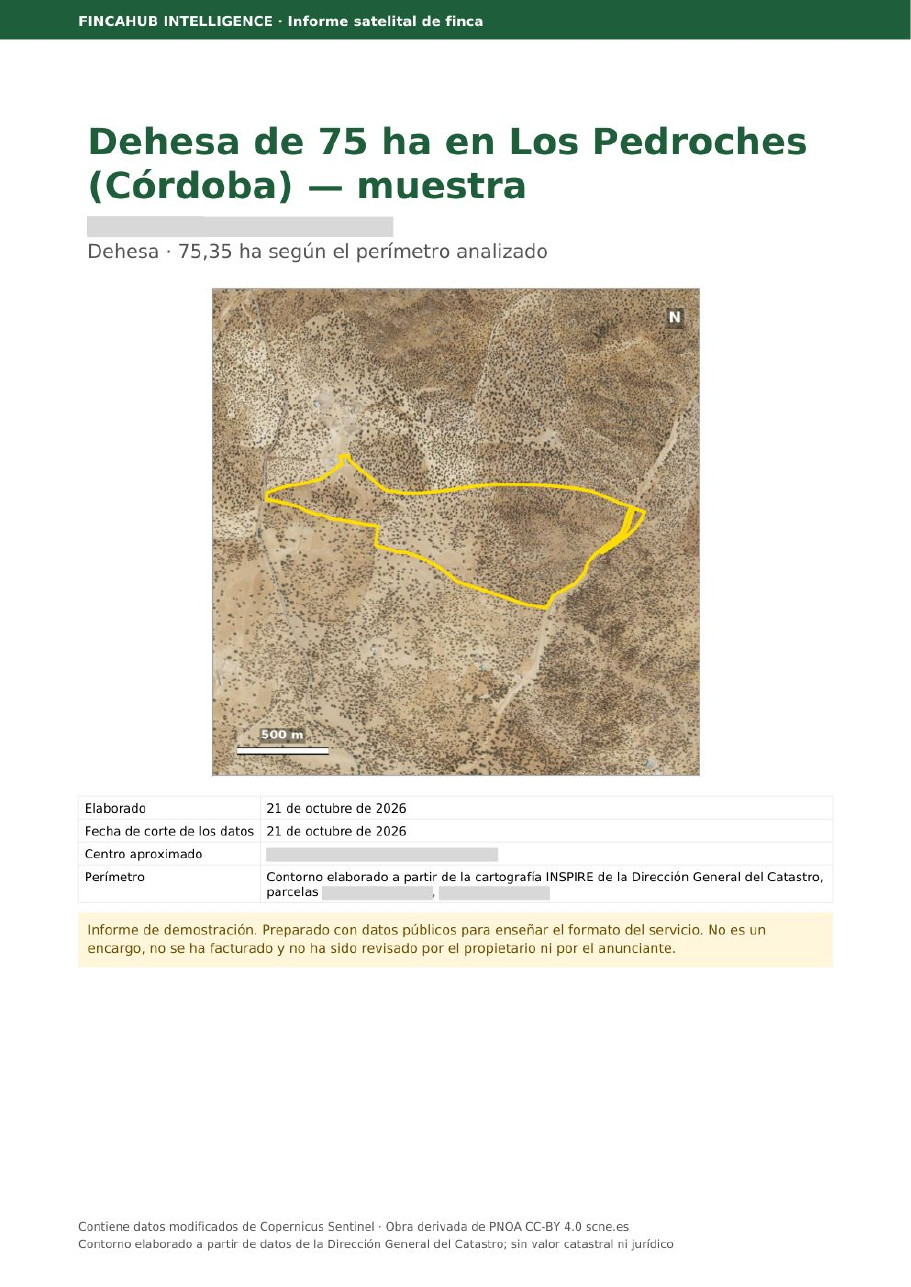
A 75 ha dehesa (oak wood pasture) in northern Córdoba, produced from a public listing. Anonymised version: no agency, no municipality and no cadastral references.
- Cover with the property sheet and the sources used
- Location and access
- Orthophotos 2005, 2013, 2022 and 2025 with the boundary
- Satellite: true colour, vegetation and change 2019 → 2026
- 36 months of monthly change
- Terrain and slopes
- Detail view of anything that stands out
- Measured areas versus Cadastre and listing
- Executive summary: observed, interpreted, questions
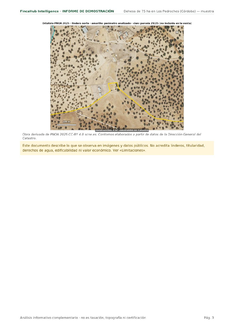
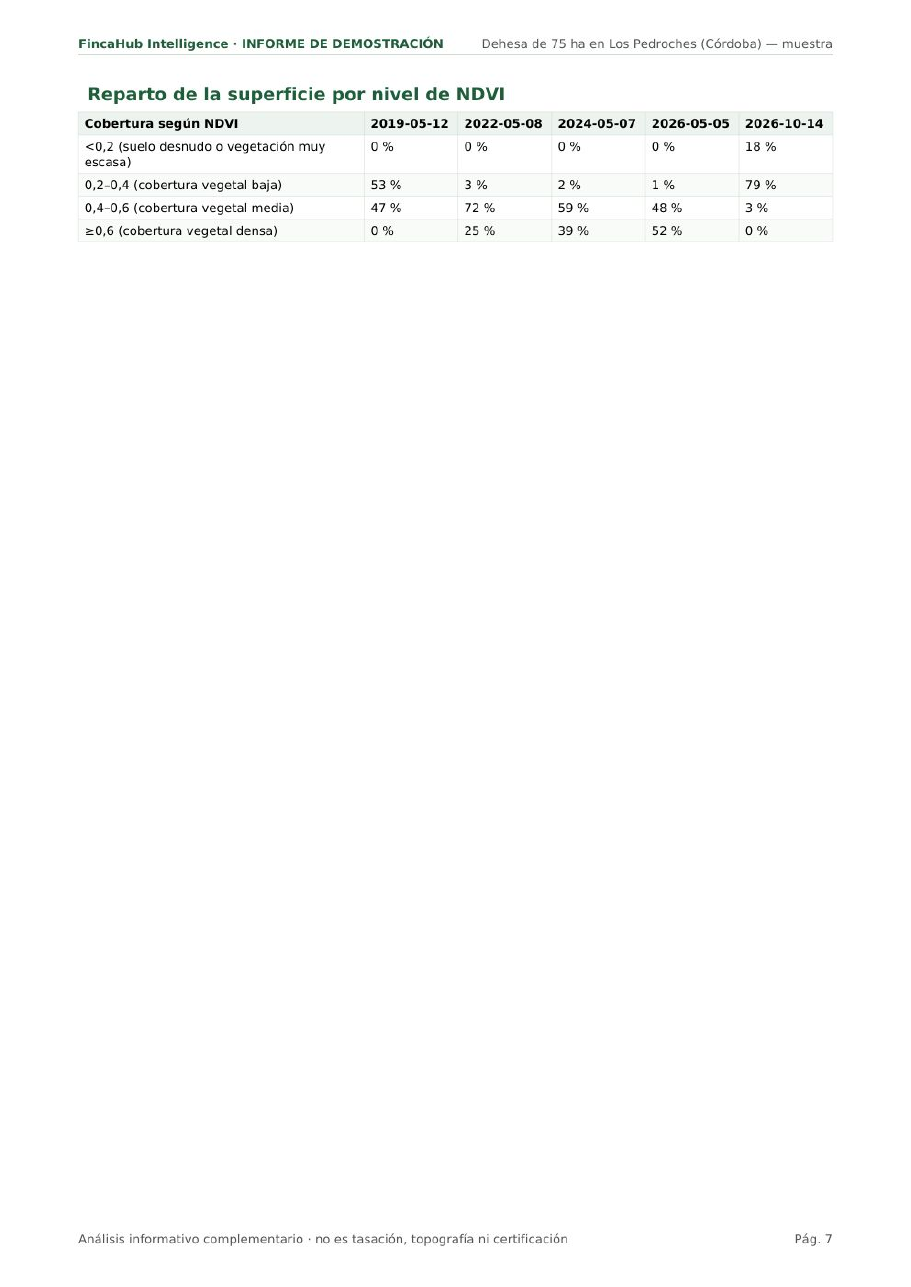
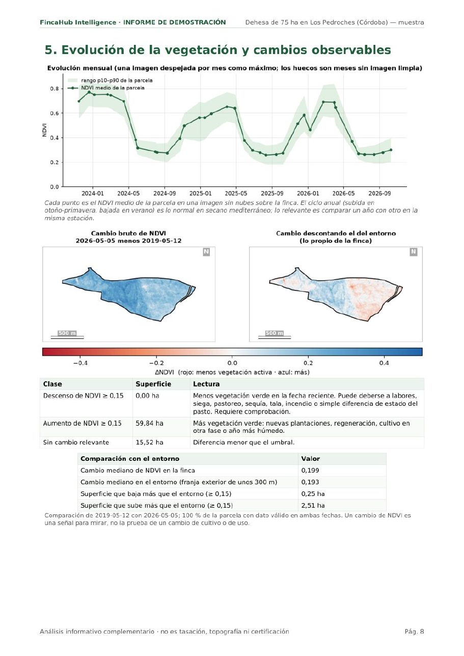
Derived from PNOA 2005, 2013, 2022 and 2025 CC-BY 4.0 scne.es · Contains modified Copernicus Sentinel data 2019, 2022, 2024, 2026 · Boundary produced from data of the Dirección General del Catastro; no cadastral or legal value.
One price, no surprises
Per report: up to 300 ha and 5 cadastral references, one detail view, in Spanish, with one correction included.
- Private buyers and sellers: €149 + VAT per report.
- Pack of 5 reports: €99 + VAT each.
- Your first property is free, so you can see whether it works with your buyers.
- Delivered within 48 working hours, as a PDF.
- Larger properties, more references or delivery in English: quoted in advance.
- The payment method is agreed when you order. There is no payment on this website.
What people usually ask us
Can I order it from another country?
Yes. It doesn’t matter where you are: if the property is in Spain, we produce the report in exactly the same way. You order by email or WhatsApp and receive a PDF. The report is currently in Spanish; ask us about other languages.
Does it work for any property?
For rural properties in Spain, yes: the sources (PNOA, Cadastre, Sentinel-2) cover the whole country. Outside Spain we can do the satellite and terrain part if you send us the boundary; historical aerial-photo coverage varies by country. It also works for villas, houses with land, warehouses and building plots: we compare what the Cadastre says with what can be seen from above (pools, extensions, porches). Not for flats: from the satellite you only see the building’s roof.
How long does it take and what do you need from me?
48 working hours from when we have the listing or the cadastral reference. We do not need access to the property or any documents from the owner.
Can I give it to the buyer as it is?
Yes, that is what it is made for. It carries the source attributions and the notice of what it is not. It can carry your agency’s logo if you ask.
Does it replace a valuation or the land-registry extract (nota simple)?
No. It complements both: it tells you what is worth checking in them and on the viewing.
What if the listing gives the wrong polygon and plot?
It happens often. We spot it when we cross-check the listing with the Cadastre and tell you before producing the report; one correction is included.
How do I pay?
It is agreed when you order, and an invoice is issued. There are no payments on this website. Your first property is free.
Send us a listing and we will send you back the report
Your first property, free. By WhatsApp or by email, whichever you prefer.
We reply on working days. Granada, Spain.